Glacial geological formation: sedimentary deposits

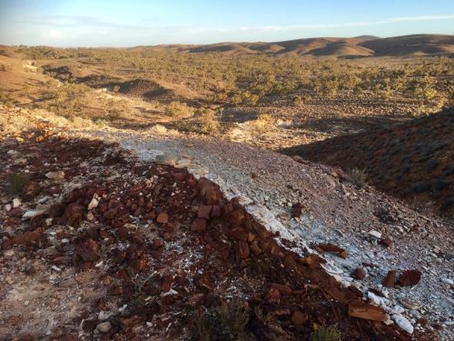
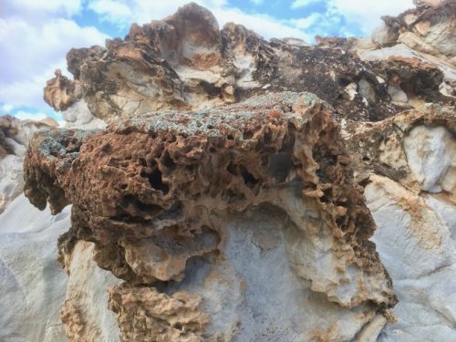
This striking outcrop near Copley exhibits a range of sedimentary deposits. From the north to south, green shale and blocky siltstone meets weathered sandstone. This is followed by a distinct tillite layer between two dolomite layers, and a thin layer of quartzite. Further along, siltstone layers coloured by iron oxide, and more weathered sandstone.

Recent studies in the area suggest that the northern Flinders Ranges area was a shallow marine or lagoonal setting prior to the climate changing into one of the earth’s most severe glaciations ever recorded (the global Sturtian Glaciation), 720 million years ago . Over these older rocks, we find layers of pebbly, mixed rocks (called diamictites) that were likely deposited by a glacier at its edge, along with some sand layers (Bolla Bollana Tillite). These rock  layers are thought to show the movement of the glacier as it advanced and retreated along the coastline. These layers then change into sandstones and mudstones with large rocks (called dropstones), which probably formed when the ice started to melt, in an area just in front of the retreating glacier (Wilyerpa Formation). After the glacier melted, the layers of rock that formed (Tapley Hill Formation) include thin, layered shales and carbonates that were deposited underwater.

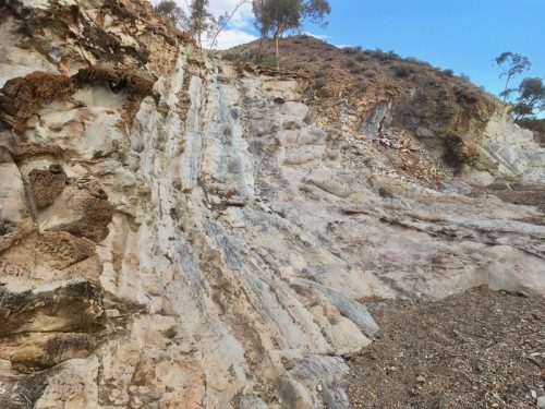
Weathered sandstone:

Continue reading “Glacial geological formation: sedimentary deposits”

Geological formation: West of Copley

A trip to the hills west of Copley revealed a fascinating array of sedimentary rock formations. Within an approximate 100 metre square area, extensive layering was apparent. Dolomite layers were dominant to the south, typical of the local magnesite bearing formation. Within these layers were granular conglomerates with silicified seams.

Further along to the north were finely banded dolomites.

Evidence of glacial deposits was seen in tillite, pebbly layers and a course sandy / silty matrix.

Continue reading “Geological formation: West of Copley”

The Legacy of Time: Story of the Flinders Ranges

Excerpt: The legacy of time

First published by The Royal Geographical Society of South Australia Inc. in 1995.

The Flinders Ranges have been shaped by geological processes that, over hundreds of millions of years, have built the stage upon which the drama of biological interactions is being performed.

The Flinders Ranges form part of a highland chain extending from Kangaroo Island in the south through the Mount Lofty Ranges and Flinders Ranges to Marree and beyond in the north, to Olary in the east, and to Spencer Gulf and Lake Torrens in the west. Like many other mountain chains, they began their history as a subsiding sedimentary basin.

During the late Precambrian era, the Earth’s crust in South Australia consisted of granitic, metamorphic, sedimentary and volcanic rocks formed between 2600 and 1400 million years ago. In the present Flinders, the only rocks from that time are exposed near Arkaroola, including what are now known as the Freeling Heights Quartzite, Terrapinna Granite (Terrapinna Tors Walk) and Mt Neill Granite. Rocks that now constitute the eastern states of Australia were yet to form and the ancestral Pacific Ocean may have had its shores in South Australia. To the south, Australia was still joined to Antarctica.

The main area in South Australia then lay west of an approximate line from Adelaide to Oodnadatta; a smaller one existed in the vicinity of Lake Frome. The intervening area, where the Flinders and Mount Lofty Ranges now stand, became a long-lived basin known as the Adelaide Geosyncline, in which sediments accumulated 800 to 500 million years ago.

Continue reading – download PDF The Flinders Ranges – Legacy of Time