

Cloud iridescence
High altitude convection cloud consisting mostly of ice crystals, Cirrocumulus floccus, at sunset during mid-summer.

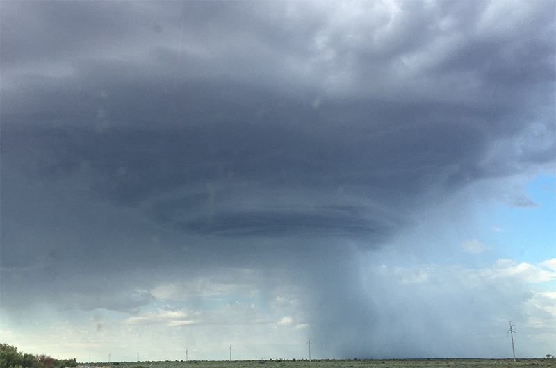
On a wild stormy day for South Australia, with 423,000 lightning strikes hitting the state, this supercell rotating updraft thunderstorm formation was seen over Nilpena Station.

High altitude Cirrocumulus clouds are formed of supercooled water droplets and ice crystals which can diffract light, such as in this instance of lunar iridescence.

Vapour trails, or contrails, are high altitude linear clouds generated by engine exhaust or changes in air pressure from aircraft flight paths, composed primarily of ice crystals. Seen here crossing the path of a waning crescent moon during a colourful Flinders Ranges dawn in autumn.


Also known as ‘hole-punch clouds’, fallstreak cloud formations occur when part of a cloud of water droplets freezes into ice crystals which grow large enough to fall below as a fallstreak. Read more about fallstreak and other clouds at the Cloud Appreciation Society.