Ripple Rock: Parachilna Gorge road


The Merinjina Tillite was formed by glacier transportation of silts, sands, rocks and boulders which came to settle on the sea floor as the glacier melted, 643 -750 million years ago.
For more information on how to locate this site, see Geological Field Excursion Guides.

Volcanics are not a common sight in the Flinders Ranges but an example of Wooltana Volcanics is visible on the Paralana Hot Springs Road at Arkaroola. The role of volcanic activity in the formation of the Flinders Ranges is outlined in the essay Legacy of Time by the Royal Geographical Society of South Australia.
For more information on how to locate this site, see Geological Field Excursion Guides.


Limestones and Dolomites of the Balcanoona formation were fractured by fault activity and infilled with silica rich waters, cementing into this silicified breccia on the Paralana Hot Springs road.
For more information on how to locate this site, see Geological Field Excursion Guides.

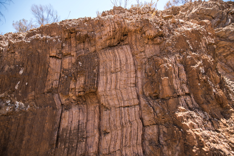
The stunning Ochre Wall on the road to Paralana Hot Springs is the comprised of weathered laminated silts and shales of the Angepena Formation.

For more information on how to locate this site, see Geological Field Excursion Guides.

Ripple rocks seen throughout the Flinders Ranges are likely to have been formed in sandy shallow waters, rapidly covered in kilometres of sediments which resulted in rock formation through processes of heat and pressure. This example is part of the Blue Mine Conglomerate Formation, around 800 million years old.
For more information on how to locate this site, see Geological Field Excursion Guides.
An outcrop of Blue Mine Conglomerate Formation can be seen at Kingsmill Creek near the Arkaroola Homestead. This conglomerate was formed around 800 million years ago and contains fragments of blue quartz from the 1.59 billion year old Mount Neil Granite Formation seen closer to Paralana Hot Springs. The Blue Mine Conglomerate was likely formed from shoreline or fluvial deposition and is seen at this site as a weathered pavement surrounding a waterhole.


For more information on how to locate this site, see Geological Field Excursion Guides.


This Opaminda Formation near the Arkaroola Village was deposited in shallow waters around 800 million years ago. This lightly metamorphosed outcrop exposes ripple marked sandstone, laminated and a green talcose siltstone (pictured).
For more information on how to locate this site, see Geological Field Excursion Guides.
This xenoclast has been plucked from ancient basement rock at a great depth, beneath the shales and sandstones of the Flinders Ranges. Such clasts were carried up very slowly by a column of hot fluid rock salt (a bit like lava) in an intrusion-like structure known as a ‘diapir’. The salt column of the Blinman Diapir is kilometers in diameter and at least a kilometre to its base. Its shape and its emplacement mechanism have much in common with a lava lamp.
This outcrop can be seen on the roadside of Glass Gorge, 200m past the grid heading west from Blinman.


The Nuccaleena Formation is a narrow pink dolomite layer that is frequently found in outcrops across the Flinders Ranges, and is described as being a good ‘geological marker horizon’.
This Nuccaleena Formation outcrop, just 5m wide, is seen in Parachilna Gorge, between the Brachina Formation siltstones and the older calcereous Elatina and Trezona Formations.
Read more about the formation of the Flinders Ranges in The Legacy of Time.